Geophysical & Geotechnical Solution
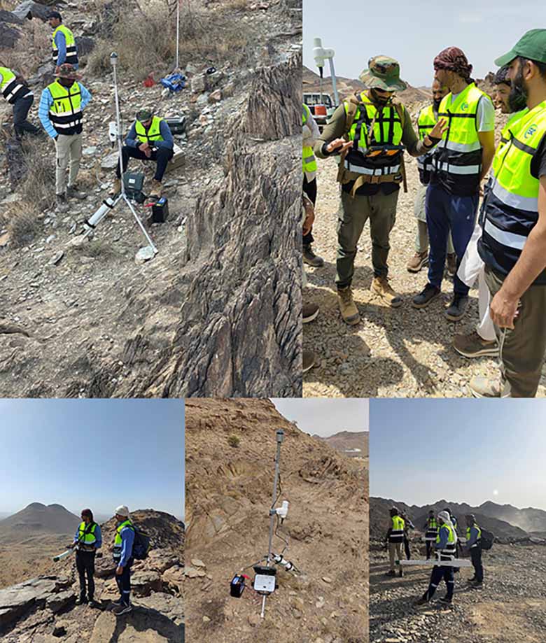
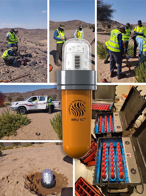
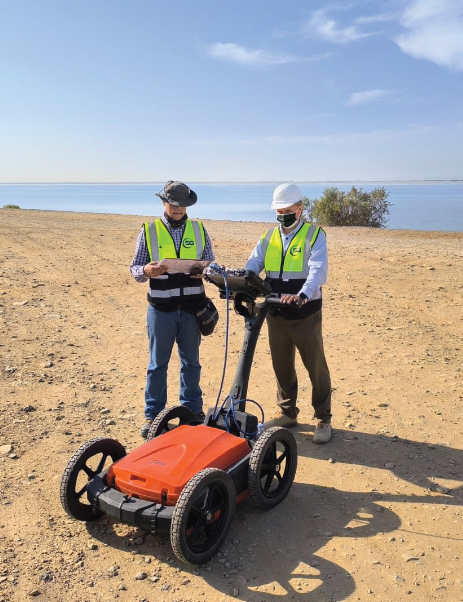
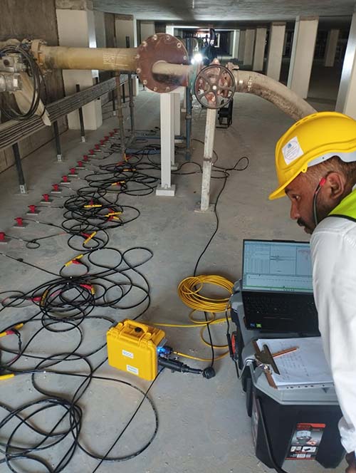
At Saudi Geophysical, we pride ourselves on delivering comprehensive geophysical services tailored to meet the unique needs of our clients. Our expertise spans a wide range of applications, including seismic surveys, magnetic and gravity surveys, and electromagnetic methods. We have successfully completed numerous projects, such as the seismic exploration of the Rub’ al Khali Basin, subsurface mapping for urban development in Riyadh, and geotechnical investigations for major infrastructure projects across the Kingdom. Our commitment to precision, innovation, and safety ensures that we provide unparalleled service and reliable results for every project we undertake.
Electrical Resistivity Tomography (ERT)
Instrument
SYSCAL Pro 96 system
Water Resources
- Locating conductive faults in fractured aquifers
- Assess water table characteristics
- Characterize saltwater wedge extension in groundwater
Environment
- Pollution Monitoring
- Detect leaks and monitor degradation in waste disposal sites
- Locating buried structures
Natural Hazard
- Detect and characterize cavities
- Assess landslide extension and volume
- Detect and locate clayey layers for geotechnical application
Mineral Exploration
- Detect dike types of orebodies
- Deep orebody detection
- Detect lens type of orebodies
Vertical Electrical
Sounding (VES)
Instrument
SYSCAL Pro 96 / SYSCAL R2
Water Resources
- Locating conductive faults in fractured aquifers
- Assess water table characteristics
- Characterize saltwater wedge extension in groundwater
Environment
- Pollution Monitoring
- Detect leaks and monitor degradation in waste disposal sites
- Locating buried structures
Natural Hazard
- Detect and characterize cavities
- Assess landslide extension and volume
- Detect and locate clayey layers for geotechnical application
Ground Penetrating Radar (GPR)
Instrument
GSSI SIR 4000 GPR as following:
- Multiple low frequency antenna (MLF) (16,20,35,40 and 80), Depth Range: 0-75 m
- 100 MHz – Shielded Antenna, Depth Range: Monostatic: 2-15 m / Bistatic: 0-30 m
- 200 MHz – Shielded Antenna, Depth Range: 0-9 m
- 400 MHz – Shielded Antenna, Depth Range: 0-4 m
Mining & Quarrying
- Placer deposits in Mineral Exploration
- Tunneling & Underground Mines
- Quarry Rock Quality
Geotechnical Engineering
- Sinkholes/Karst features
- Stratigraphy, Soil Structures
- Mine Shaft Detection
Hydrogeology
- Water Table
- Saltwater Infiltration
- Moisture Content in soil
- Bathymetry & Sub-Bottom Profiling
Time Domain
Electromagnetic (TDEM)
Instrument
Geonics ProtemTEM57-MK2A
Water Resources
- Locating conductive faults in fractured aquifers
- Assess water table characteristics
- Characterize saltwater wedge extension in groundwater aquifers
Environment
- Pollution Monitoring
- Detect leaks and monitor degradation in waste disposal sites
- Locating buried structures
Natural Hazard
- Detect and characterize cavities
- Assess landslide extension and volume
- Detect and locate clayey layers for geotechnical application
Mineral Exploration
- Detect dike types of orebodies
- Deep orebody detection
- Detect lens type of orebodies
Multi-Channel Analysis of Surface Waves (MASW)
Instrument
Geometrics Geode (24 Channels)
- Determining the depth and thickness of stratigraphic layers
- Identifying sinkholes/cavities, (weak) zones, Fracture zones, voids, and saturated soil.
- Determining soil and rock elastic properties
- Calculation of Shear velocity


Downhole Seismic
Instrument
RAS-24 Seismograph/ Geode 24 channels
Determining soil and rock elastic properties as following:
- V1 for P and S-waves
- V2 for P and S-waves
- Poisson’s ratio
- Young’s Modulus
- Shear Modulus
- Bulk Modulus

Ground Magnetic Survey
Instrument
G-858 Cesium-Vapor magnetometer
Water Resources
- Locate conductive fault in fractured aquifer.
- Assess water table characteristics.

Gravity and Microgravity Survey
Instrument
CG-5 Gravimeter system
Applications of Gravity Survey
- Locate Basin geometry
- Determine Bedrock depths
- Determine Fault locations
- Locate subsurface cavities, Fracture zones, voids.
- Location of local density changes

